Cookie Consent by Free Privacy Policy website Document: Makolkol FCA 15-09 map | Forests Portal

Makolkol FCA 15-09 map

Concessions mentioned in this document:


                340,000                               350,000                                         360,000                                            !
                                                                                                                                                         (
                                                                                                                                                               370,000


            Legend
            !
            (
                Settlement
                Road
                Makolkol FCA Boundary
9,470,000


                                                                                                                                                                            9,470,000
                                                                                OPEN BAY
                                                                                TIMBERS
                                                                                !
                                                                                (


                                                                   VUNAPEO
                                                                            !
                                                                            (


                                                                   MATANAKUNAI
                                                                        !
                                                                        (
9,460,000


                                                                                                                                                                            9,460,000
                                                                                           SAI
                                                                                           FORESTRY
                                                                                           !
                                                                                           (


!
(


                                   PALE                                                                RICE
                                   !
                                   (
                                                                                                       CAMP
                                                                                                       !
                                                                                                       (
9,450,000


                                                                                                                                                                            9,450,000
9,440,000


                                                                                                                                                                            9,440,000


                340,000                               350,000                                         360,000                                                  370,000


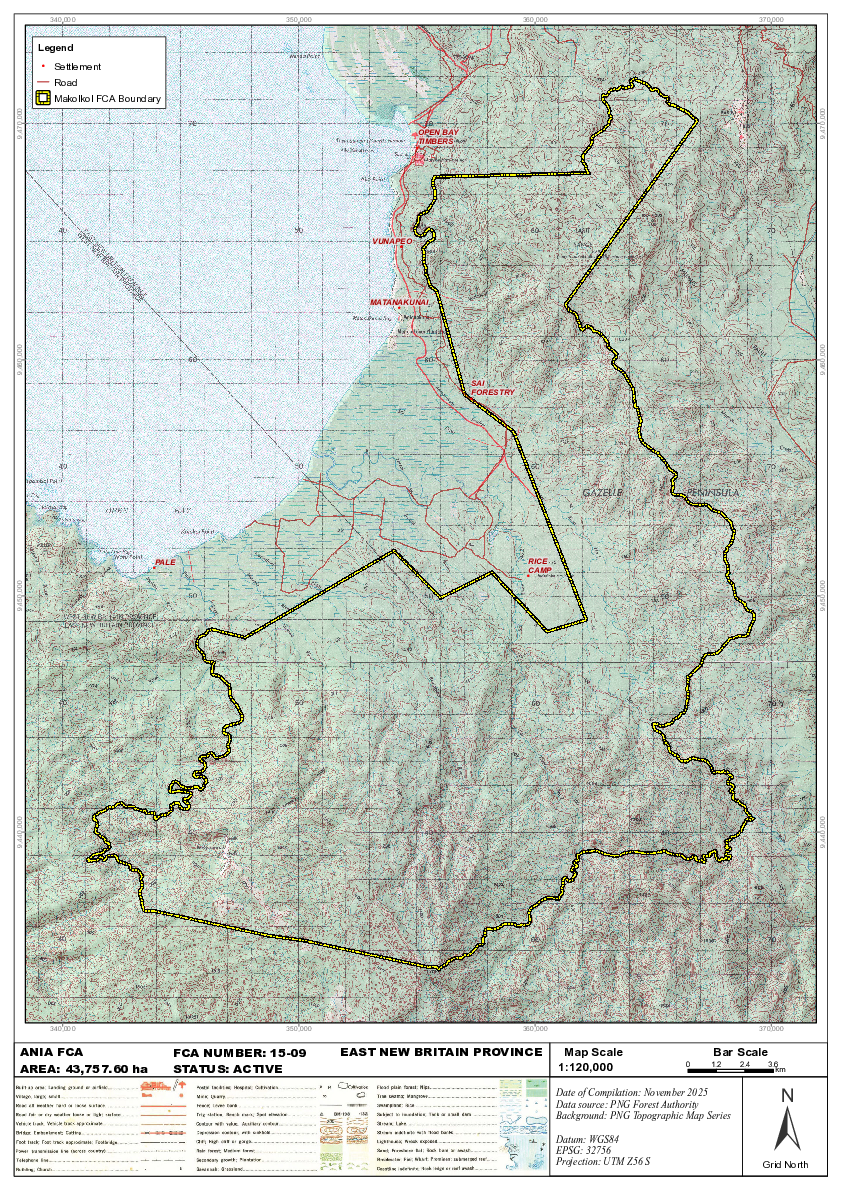
     ANIA FCA                           FCA NUMBER: 15-09       EAST NEW BRITAIN PROVINCE                        Map Scale                        Bar Scale
     AREA: 43,757.60 ha                 STATUS: ACTIVE                                                          1:120,000                   0    1.2     2.4     3.6
                                                                                                                                                                   km


                                                                                                                                                                   ±
                                                                                                                Date of Compilation: November 2025
                                                                                                                Data source: PNG Forest Authority
                                                                                                                Background: PNG Topographic Map Series

                                                                                                                Datum: WGS84
                                                                                                                EPSG: 32756
                                                                                                                Projection: UTM Z56 S                          Grid North
                                                                                    !
                                                                                    (

Page 1 screenshot